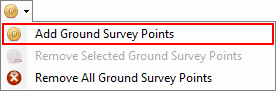
Add Ground Survey Points |
  
|
Add Ground Survey Points |
|
![]()
Use this tool to add Ground Survey Points to the map from a file, Ground Survey Points improve the accuracy of the terrain for the survey area, this data is usually captured using a survey grade GPS.
'Ground Survey Points' are stored within the CHPS project and will affect the CHPS Elements the same way as permanent terrain points on the map.
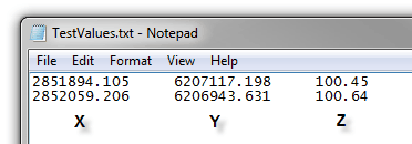
'Ground Survey Points' need to be saved into a CSV file as per the format shown in this screen shot before they can be loaded into CHPS.
Important Note: |
The coordinates in the 'Ground Survey Points' text file must be in the same coordinate system as your CHPS project, if they are not your points will be displayed in the wrong location. To learn more about Map Projections in ArcMap see the 'ArcGIS Resource Centre' |
To add Ground Survey Points to your map;
1.Prepare the text file with as shown above, with the points coordinates (X&Y) and elevation (Z)
2.Select the 'Add Ground Survey Points' tool
When your 'Ground Survey Points' have been added to the map successfully they will appear as points with their elevation value as their label.
The 'Ground Survey Points' tolerance is set in the CHPS Configuration Options dialogue. This tolerance distance specifies how close a ground survey point needs to be to a Profile line before CHPS will use the ground survey point for the elevation in stead of the available terrain.
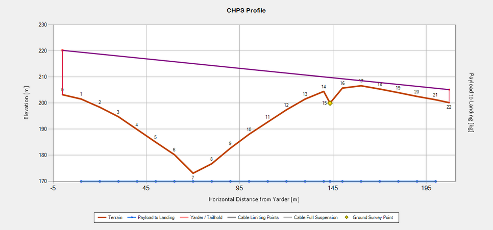
Example Profile Graph with a Ground Survey Point
http://cableharvesting.com/help//5-The_Interface.The_Toolbar.Add_Ground_Survey_Points.htm
Topic Last Updated: Tuesday, 13 September 2016